")
Now part of

Insurers operating in the competitive domestic market face a dilemma. On one hand, there is a desire to take on new business and serve existing clients better, on the other Insurers want to optimise their portfolio risk. Bringing Location Intelligence and Data Analytics to bear on this can be instructive and rewarding.
One market that may be underserved at present is household insurance for those who live in multi-storey buildings located within flood zones. We have written previously about the number of residential buildings that lie within flood zones. However, while these buildings may be at risk, not all of the households within them are. Those who live above the ground floor in a multi-storey building obviously have a lower risk of their residence being flooded than ground floor properties. Despite the lower risk, those properties on the upper floors of multi-storey buildings may be underserved by insurers who have made the decision to rule out the entire building based on its location.
How big a potential market is this?
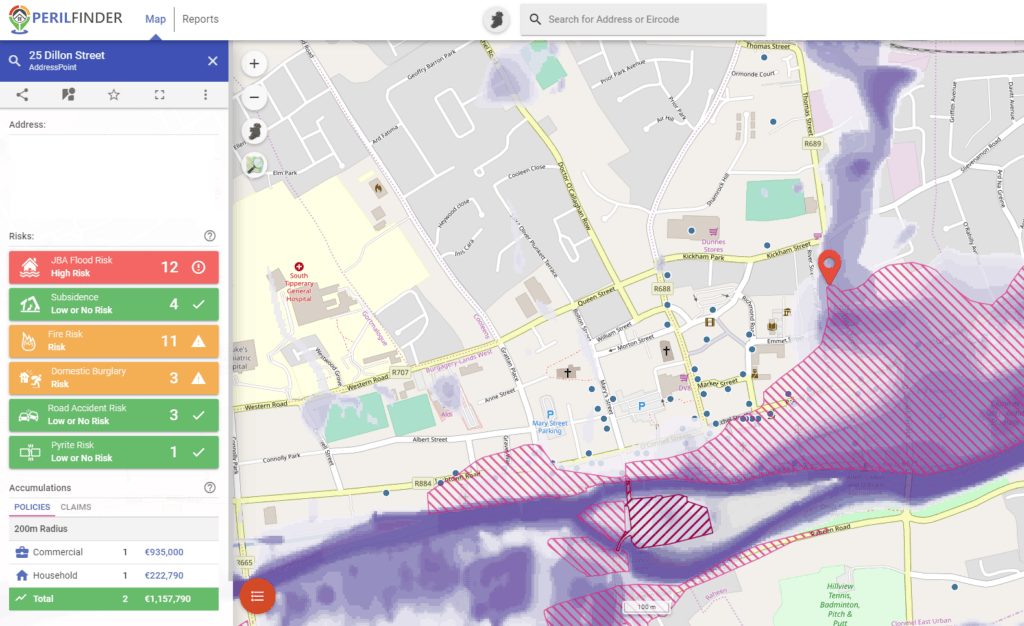
The Eircode database can tell us exactly where a building is and how many residential addresses there are in it. A simple query gives us our starting point: There are 6,625 buildings containing more than 1 residential address point which are in Perilfinder™’s Flood Risk Zone. These buildings contain more than 45,000 residential addresses and are home to well over 100,000 people.
But how many of these are above the ground floor? Working with building outline and height data would give highly accurate results, but even without that data to hand, we can make a number of baseline assumptions to get an indicative answer.
First of all, we can look at mixed-use buildings. These are buildings which contain both residential and commercial addresses. Addresses such as farms, home offices and B&B’s are ruled out as they do not contain multiple residential addresses. However, flats and apartments above shops are included, as long as there are two or more residential addresses in the building. There are 1,270 buildings like this in the Flood Zone, containing 10,874 residential address points (RAPs). If we assume that 90% of these are above the ground floor then that gives 9,787 potentially underserved addresses from this type of building alone.
We can also make some assumptions about the 5,355 buildings containing almost 36,000 Residential Address Points (RAPs) that are purely residential. One assumption is that the higher the number of addresses in a building the lower the proportion of those addresses which are on the ground floor. This won’t be universally true of course, there are some large apartment complexes with hundreds of units that are only 2 or 3 storey, but broadly speaking this will be true. If we assume that buildings with 2-4 RAPs have 50% of these above the ground floor, and gradually increase the proportion of above-ground RAPs up to 80% for buildings with over 50 RAPs, that gives us 21,668 addresses in residential buildings that may be unserved at present.
Adding the multi-use and residential only building types gives us a total potential market of 31,454 RAPs, which is a significant market opportunity.
In areas with widespread LiDAR data availability, building footprints and heights can be extracted to give a more accurate figure. Keep an eye out for an upcoming blog post on that.
@ 2019 Gamma.ie by Richard Cantwell
About Gamma
Gamma is a Location Intelligence (LI) solutions provider; we integrate software, data and services to help our clients reduce risk through better decision-making. Gamma was established in 1993 and was the first company to develop LI for the private sector in Ireland. The company has expanded to become a global provider of cloud-hosted LI systems, micro-marketing solutions and related services. Gamma Location Intelligence’s Perilfinder™ risk mapping platform is the number one underwriting solution used by Irish insurers to assess environmental risk.