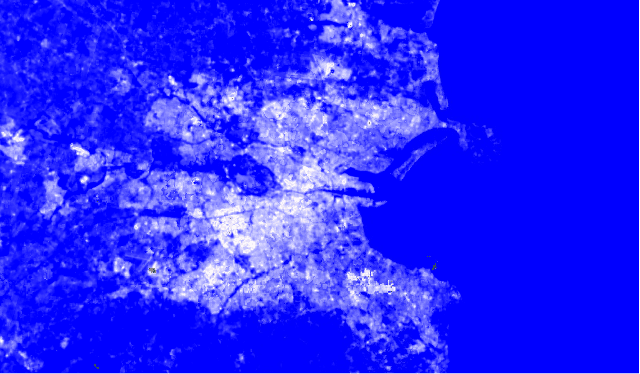
A recent story from Bloomberg looked at heat and cool islands in a range of global cities, from London and Seville in Europe to Delhi, Los Angeles, Melbourne and Fez in Morocco. Dublin didn’t make the list, but we at Gamma were able to map out heat islands and cooler areas in the city using Thermal Infrared Sensor (TIRS) data from Landsat 8.
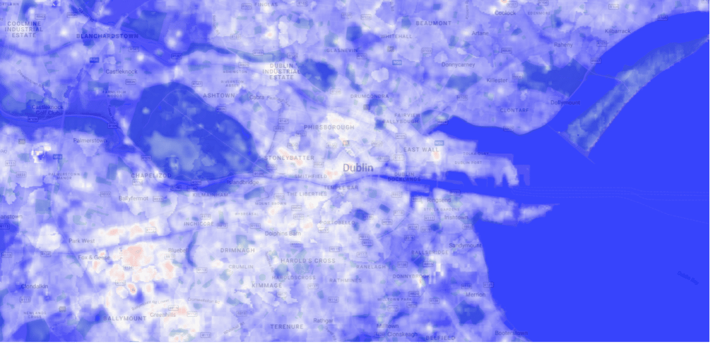
The output is very interesting. Heat Islands in the industrial areas in the west of the city from Park West to Greenhills clearly stand out, as does high density housing areas such as Stoneybatter and the Liberties. The retail core area around Henry Street towards the Fruit Market also jumps out. Capel Street might be one of the world’s coolest streets, but it’s one of the warmest in the city centre. The city’s parks are clearly the places to cool down on hotter days. Phoenix park is an oasis of cool, obviously, but much smaller parks such as Stephen’s Green and Merrion Square can be seen in the data. While the Liffey has a limited cooling effect in the city centre, the course of the Dodder across the southside of Dublin spreads cooling in that part of the city.
Heat island mapping in a city like Dublin is not only useful at the height of summer. It can provide targeted information almost to the building level where insulation and energy efficiency improvements can have a large impact in winter.
Gamma is a Location Intelligence (LI) solutions provider that integrates software, data and services to help its clients reduce risk through location intelligence. Established in Dublin, Ireland in 1993, and with offices in Manchester, UK and Bilbao, Spain, the company focuses heavily on cutting-edge research and development projects, leveraging Artificial Intelligence and machine learning.
")